Land surveying is the process of determining angles, distance, elevations
and directions between points on Earth. This is then used to create maps, locate boundaries and
assist in site layout. We specialise in surveying sites of all sizes with a variety of
traditional and modern methods. Combining our 45 years experience and different backgrounds, we
provide innovative ways to carry out our work.
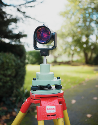
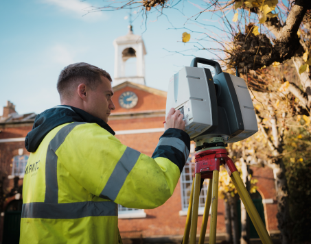
We also utilise the latest GPS Systems, Robotic Total Stations and 3D Modelling Software to
provide precise Land Surveys, Mapping and GPS Surveys. Through the use of satellites we can
conduct GPS surveys allowing us to gain highly accurate data via signals received from the
satellites. This data can be used to determine exact locations and allows for real-time
surveying due to the speed it’s collected at, in turn, enabling us to map large areas quickly
and in great detail. We can then apply it to a number of other surveys .
Specifications are tailored to individual projects, and we ensure to meet all Planning Authority
requirements as specified, such as Architectural Offices, Flood Risk Consultants and
Designers.
We often work on:
Existing Commercial Site Surveys
Our Existing Commercial Site Surveys help you understand
the pros and cons of a property,
allowing you to more accurately calculate the value of the property. This puts you in a
position to be able to negotiate leases or purchase prices with extensive knowledge of
the property to back it up. It also allows for any repairs to be discussed and planned
early, before they cause any issues.
As Built Surveys
Our team of surveyors have expertise in providing detailed
‘As Built’ Surveys to assess the progress of a project. We can provide sketches of the
project to compare against your design drawings. This will give you a clear picture of
the finished project relative to the plans provided, enabling you to easily spot any
deviation from the original plans. We are also able to carry out monitoring of sites,
tailoring our method to fit each individual job to avoid interrupting operations.
Greenfield Site Surveys
Greenfield sites are undeveloped pastures of land, either
used for farming, landscape design, or left to evolve naturally. We can undertake
various surveys and reports on such sites to assist with designing and planning the new
development.
Major Roads and Junction Surveys
Highway surveys provide detailed plans of existing road
networks. We can carry out an accurate survey of the highway with minimal disruption. We
identify any features on the road such as the location of the kerb, utilities, overhead
cables, neighboring buildings, etc. Highway surveys are essential for the use of
transport planners, architects, and engineers to understand and assist in designing new
junctions and other changes in the road for projects and developments.
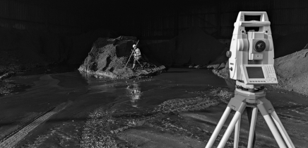
Quarry/Landfill Surveys
Quarry surveying is essential for evaluating ongoing mining
and quarrying activities. Through a quarry survey, we can help you protect your assets,
map rock profiles, and even calculate the quantity of extracted materials. Point cloud
data for a quarry survey can be collected within a day. It’s then used to generate
highly accurate 3D models and maps of the quarry site.
Watercourses and Flood Plain Surveys
Watercourse/flood plain surveys are vital for the purpose
of flood risk assessment reports. Flood Risk Assessments are required for most
developments within one of the flood zones. We can help you establish what flood zone
your development is in and work with flood risk consultants to help you resolve any
mitigation issues..


 1 Woburn House, South Street, Vernongate, Derby, DE1 1UL
 1 Woburn House, South Street, Vernongate, Derby, DE1 1UL
 info@mapmatic.com